
")
")
1. Data collection
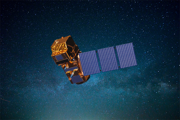 The first step of the variable application process with Varistar is to obtain long-term and up-to-date data on vegetation at selected hunts. The basic source for the Varistar system is an extensive database of historical satellite images from PlanetScope constellation. Satellite images that provide information about the state of the vegetation are available with many years of history and in resolution 3x3 meters which is more than 10x more than commonly used imagery.
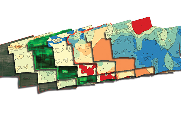
The satellite photos, information on crop plan, harvest dates and yields for the last ten years are used to produce maps of the relative yield potential, which divide the plots into individual production zones. Precise processing and thorough control of relative yield potential maps are essential for the proper functioning of the entire system. Therefore, we always thoroughly browse and validate maps with clients to accurately reflect the state of their hunt and deliver the best possible results.
Using information from PlanetScope constellation, we are able to get current images on a daily basis. To eliminate cloudiness, we use unique image-folding technology and add additional available information to these images. Application maps prepared on the basis of relative yield potential maps can be supplemented with information on the current state of the field. By combining them, we obtain a reliable basis for variable application.
Using information from multiple satellites, we are able to get current images on a daily basis. To eliminate cloudiness, we use unique image-folding technology and add additional available information to these images. Before application, we will complete verified and agreed maps of relative yield potential (RVP) with information about the current state of the vegetation. Combining them gives a reliable basis for the variable application.
We always want to use the maximum available data about your fields to maximize the accuracy of the resulting applications.
2. Data processing
After careful processing and maps validation of relative yield potential, the system can be used. Each agronomist is master of his field; therefore, each application is prepared individually according to agronomist's requirements based on his agrotechnical knowledge, requirements and experience. This information is transmitted in a simple and comprehensible form and on the basis of these materials’ application maps are prepared. For example, protection zone requirements and other specifics can also be included in application maps.
However, Varistar uses satellite images and other planimetric information during the season not only to prepare application maps but also, for example, to verify the correctness of the application and to identify potentially hazardous places - so-called Smart Scouting. The Smart Scouting analysis is available on our Varistar Portal. The analysis can be processed on the basis of any available satellite image (even historical) to identify production risk zones (these are zones where the crop fails or on the contrary, zones where the crop is very beneficial).
On the basis of soil analyses and a map of the real yield potential, it is possible to prepare an application map for slow release fertilization, using soil conductivity data it is possible to prepare data for variable soil processing.
Further information (yields, plant analyses, etc.) is used to verify the strategy and quantify the benefits and to continually improve the underlying data (especially RYP maps) and to increase your profit over the long term.
3. Application management
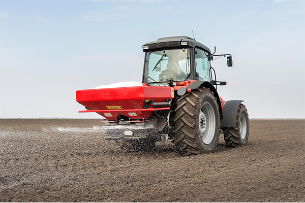
The Varistar system allows connection to a wide range of spreaders, sprayers and seeders from most major manufacturers such as Amazone, Bogballe, Fieldstar, Horsch, Kuhn, Kverneland, RDS, Vicon, Väderstad and others. Built to be economically available to conventional farms without major investments, Varistar covers not only the latest application technology but is often able to use machines that are more than 15 years old to perform variable applications. The compatibility of the Varistar system with the technology of our clients is always assessed individually to find a technically and economically suitable solution.
Processed application maps are uploaded remotely and unattended to the application device terminal. Varistar uses application terminals that are set up to require minimal operator intervention during the application. In case of a problem during the application, it is possible to take the terminal screen from our call center and provide correction for continuing the application without unnecessary downtime. After the application is finished, the scanned data is downloaded from the terminal and processed, comprehensible interpretation for you and above all their use in the future to increase the profit of your farm.

